


Routes from Santa María
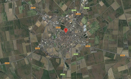
The central geographical location of Santa María in the Páramo Leonés region, of which it is currently the head of services, and its privileged situation as it is the crossroads and crossroads of several autonomous (CL-621 and CL-622) and provincial (LE- 413 and LE-6523), as well as being very close to links with expressways such as the A-6 (Autovía del Noroeste) and A-66 (Autovía Ruta de la Plata) and motorways such as AP-71 (León-Astorga ), make it possible to be the origin of different routes to different towns in the Leon and Zamora provinces, located less or a little over an hour away by car, such as:
- León (35 km.)
- Órbigo Hospital (18 km.) And Carrizo de la Ribera (34 km.)
- Astorga (34 km.) And Castrillo de los Polvazares (40 km.)
- Ponferrada (100 km.) And Villafranca del Bierzo (120 km.)
- La Bañeza (15 km.), Jiménez de Jamuz (20 km.) And Villanueva de Jamuz (24 km.)
- Benavente (52 km.) And Lagunas de Villafáfila (80 km.)
- Valcavado del Páramo (19 km.) And Laguna de Negrillos (18 km.)
- Valencia de Don Juan (21 km.) And Valderas (47 km.)
- Sahagún (87 km.)
- Mansilla de las Mulas (45 km.) And Cistierna (88 km.)
Other routes that can be done in / from Santa María del Páramo or in its vicinity, may be the following:
The town has a perimeter promenade parallel to the ring road of just over 5 kilometers that surrounds the entire urban area, also during the tour you can enjoy the botanical path that runs at the same time and a complete bio-healthy circuit.
In addition, from Santa María del Páramo there is an urbanized pedestrian promenade to the neighboring town of Laguna Dalga, whose approximate route (round trip) is 5 kilometers. This route runs parallel to the road and has trees, benches to rest and its own lighting. A similar route to Urdiales del Páramo will be built shortly.
Likewise, in Santa María del Páramo you can make numerous routes both on foot and by bicycle because depending on the geographical situation in which it is found, infinite agricultural roads leave the town where you can move to nearby towns or make routes of many kilometres.
Hiking trails of the Poeda area:
- The Wine Cellars Route (7.9 Km). Valdevimbre. (INFO) .
- Route of the Castles (17.9 Km). Valencia of Don Juan. (INFO).
- Órbigo Route (R1.2) (8.6 Km). Llamas de la Ribera. (INFO).
- Órbigo Route (R1.3) (18.45 Km). Órbigo Hospital. (INFO).
Hiking trails of the Poeda Zone (Trino Ornithology Program):
- Canal del Bajo Páramo Route (6.7 Km). Dalga Lagoon. More information (FLAYER 1 y FLAYER 2)
- Route through the Chozas Lagoons. Down Huts. More information (FLAYER 1 y FLAYER 2)
- Barriers Route (2.4 km)
- Route of the Villages (6.5 km)
- The Lagoons Route (21 km)
Bike Routes of the Poeda Zone:
- Páramo BTT Route (14.8 Km). Between the towns of Santa María del Páramo and Bustillo. (INFO).
- BTT Winery Route (18 Km). Between the towns of Chozas de Abajo and Valdevimbre. (INFO).
- Esla BTT Route (42.6 Km). Between the towns of Puente Villarente and Valencia de Don Juan. (INFO).
- BTB Órbigo Route (R1.1) (35.6 Km). Between the towns of Villarroquiel and Veguellina de Órbigo. (INFO).
- BTB Órbigo Route (R1.4) (24.7 Km). Between the towns of Veguellina de Órbigo and Cebrones del Río. (INFO).
Routes and itineraries in Zona Poeda (Páramo, Órbigo and Esla):
More information in: www.poeda.eu/?plt=rutas